

AZT Journal Part 5: Pine to Anderson Tank
Spooky mines, scattered bones, and a creature of Arizona folklore: this is Mogollon Monster territory. Snow pack and snow melt is the name of the game through this tough-going section of the AZT. Also, who’s the stranger ahead who’s left me a message in the trail log? This lonely trail becomes a bit more friendly before the end of it.
Dear Readers,
I’m blown away by the heartfelt messages left on my last post; my heart is full. I’m happy to report that I’m doing much better because of it. Thank you to those who reached out. And thanks to Steve who donated to my campaign with AFSP National.
You’re all truly an inspiration to me, and I hope you’re all coping well during these difficult times.
Days 23 & 24: Zero in Pine + Pine to Washington Park Trailhead Camp, 20 miles
A Day off; what a treat it’s been.
My Airbnb in Pine doesn’t have a washer and dryer, plus I need to make a trip to the post office to pick up my replacement trekking pole that broke hundreds of miles back. I trek back into town, even though I’d rather be laying on the couch fattening myself up with some Ben and Jerry’s. First, I hit the post office, where the nice lady who gave me $20 the day before is standing in line in front of me. We chat for a bit, until it’s my turn to grab my resupply box and brand spanking new trekking pole. Success!
I throw my stinking clothes in the wash at the laundromat, and thankfully I had the foresight to put a change of clothes in my resupply box. They have free popcorn here while you wait, so I can’t complain too much. It’s actually somewhat relaxing as far as errands go. After that, another trip to the supermarket to stock up on some snacks to supplement my resupply, and then I walk the mile back to my little apartment.
I cook another dinner for myself, and lounge through the evening. And it’s absolutely glorious.
In the morning, I take my time getting ready to head back out. I always dislike packing away my freshly resupplied pack: there’s food shoved into all the nooks, and it’s unbearably heavy with around ten pounds of water. Before leaving, I kill off the last bit of my second pint of ice cream, and leave my comfort zone behind.
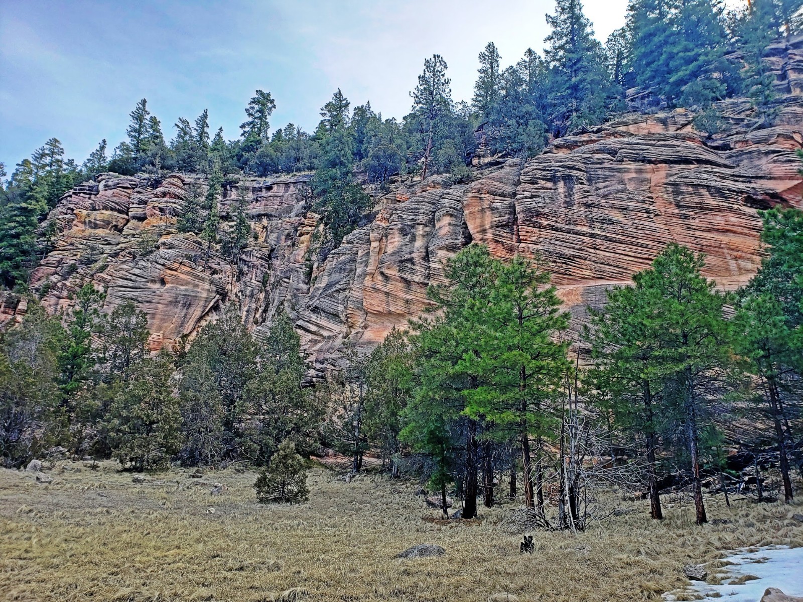
I walk up the highway back to the trailhead. It’s a bright, warm day, with a few clouds lingering in the otherwise bluebird sky. From the trailhead, it’s an immediate climb, although gradual, back into more ponderosa forest. A few miles in, I stop at a trough to eat one of the hard boiled eggs I had made myself, and replace a liter of water that I’d already drained during the climb. I fire up a podcast, and leave the forest behind for red rock canyon and yucca terrain.


There are a few day hikers in the early evening, navigating the gulches that the trail follows for some time. Once I start climbing again, I find myself back on a more solitary stretch, and the pine timbers and junipers return. A scattering of bones is strewn across the trail, and closer to my intended camp for the night, the skull of the ill fated creature: a young bear, likely a yearling.
The night has cooled off quite a bit, and the creek ford before my destination is so frigid it numbs my feet. The nip in the air has made it apparent I’m back in the higher elevations, and I prepare myself mentally for a chilly night.
Just before dark, I reach the trailhead at Washington Park, where the East Verde River roars near distance. There’s a corral here, and after finding that bear skull, I consider pitching my shelter within its sturdy metal fence. This is the territory of the Mogollon Monster, after all, Arizona’s version of Bigfoot. Don’t be silly, I tell myself, and settle in under a patch of trees instead. The low lying limbs will provide some warmth through the night, however, I am camped next to the parking area for the trail. There’s no cars or people here, so I figure no one will bother me.

Naturally, just as I’ve finished making camp and I’m enjoying my dinner, a pickup truck speeds up the road. I dash underneath my tarp and tuck my head down beneath my quilt, so they won’t be able to make out that I’m a solo woman. The truck circles the parking area a few times, spinning its tires and kicking up gravel. The last loop they make, their headlights light up my campsite, and they slow to a crawl. Thankfully, they move on and drive back down the road.
I’m exhausted from carrying an oversized pack, but I know tomorrow is going to be rough going with lots of elevation gains and snow, so I Benadryl myself to sleep. If it was a cold night, I don’t recall, because I was out like a lamp in no time.
Day 25: Washington Park Trailhead to Ponderosa Campsite, 28 miles
At the crack of dawn, I’m up. It’s so cold though, and getting out from under my quilt is the ultimate bitch. With trembling fingers, I break camp and pack it all away under a mountain of food. I eat breakfast as I walk, crossing the wooden bridge over the river and following a faint path through a burn area. The trail disappears under scree and talus, and the cairns marking the way are difficult to spot against an endless backdrop of gray rocks. Eventually, I do find an actual trail, leading up a steep mountainside. At the top of the climb, an old mine and a ramshackle shelter made of stacked up stones. I check my navigation, and as I suspected, I’m off course. Damn.


I scramble back down to the route, where a tiny cairn is standing and easily missed. I had gone straight instead of taking a sharp left on a pin turn, but the way is buried under scree and overgrown weeds. The trail abruptly climbs, paralleling a dirt road under some power lines. I follow the road instead, until it spits me out at the top where the road intersects another. In the distance, a tiny cabin sits in a stand of trees. I head in its direction, trudging through piles of snow. The front porch is a prime break spot.
I take a mini break at the cabin, near the General Springs trailhead, although no trailhead could possibly be seen under all this snow. It’s going to be a slow going day, with lots of route finding. I eat some peanut butter and try to process the difficulties that lay ahead. I’m on a plateau, and if there’s this much snow here, there’s going to be this much snow everywhere.


Further on, I follow the track of those before me, while keeping a close eye on my navigation. I stumble onto a camp early in the afternoon, with half a dozen men crammed into one snow free patch of earth. “Does the trail go over this hill?” They nod.
“And across the creek several times.” One of them says. More wet, cold feet in my near future.
On the other side of the hill, I indeed cross the creek. There’s no avoiding getting my feet wet; the creek is swollen with snow melt, and all the stepping stones are drowning under a swift current. I do this at least three times, before following the bank of the creek until it meets back up with the trail again.
Once my feet start to warm up, and the numbness in my toes fades away, I notice a throbbing sensation in my big toe. Specifically, the pain is under my toenail, and I know what I’m eventually going to have to do.
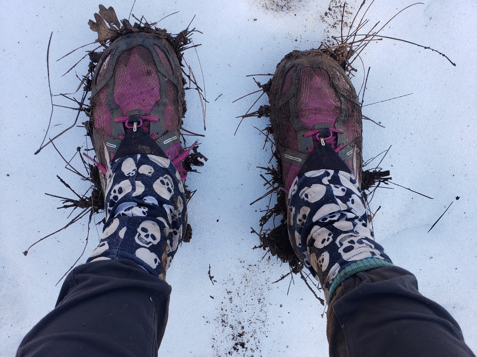
I follow a maze of dirt roads for several miles, getting off track once and then having to backtrack a mile round trip. This obviously increases my current frustrations. A flooded out trail cuts through the forest, and connects to yet another road, and I’m slogging through thick layers of standing water and mud. After a few more miles of these conditions, I finally reach Blue Ridge Campground, which is closed for the season. Somewhat shockingly, it’s dry here, and quite warm among the oak grove that covers the campsites. The pit toilets are unfortunately locked, but the dumpster is open and ready for me to rid of some trash. I take a late lunch at one of the luxurious picnic tables, and spend my time here warming up after the snow melt hell I’ve just gone through.


As the daylight fades, I wander out of the woods into a clearing, with roads running in every direction from a few different intersections. I’m beat, but I want to get these roads put behind me, so I press onward into the dusk.
By nightfall, I find a soft spot beneath a huge pine tree, and make camp there. An animal calls into the night, and a spider stumbles over the underbrush that I clear away for my tarp. Another cold night is ahead, with clear skies and a bright moon. I hunker down, bracing myself for the oncoming chill.
Day 26: Ponderosa Campsite to Mormon Lake, 27 miles
The morning starts with me shaking the frost from my tarp, and ripping my frozen quilt apart from my bivy like Bandaid stuck to skin.
I’m wading in ankle deep snow melt on saturated trail, which gives way to heaps of more snow. The trail is nowhere to be seen, and my toe is throbbing worse than ever. I won’t be able to ignore it for much longer.
Midday, I reach another trailhead, but it too, is under a few feet of snow. Surprisingly, there’s a trail register here, and the person before me has left a single, impactful comment: “Fuuuuuuuck!” The trudge continues, using a combination of Guthook and topo maps to find my way. If there isn’t snow, then the rest of it is flooded out.
I finally find a dry patch with a stump protruding from the ground, and I take the time to rest and tend to my toe. I peel back my soggy sock to find a red, swollen, and rather pruned big toe. A blister has formed under the nail, which is white with death. After a snack, and mustering the courage to take care of the situation, I dig out the needle from my makeshift sewing kit, and an alcohol wipe to sterilize it. I lance the blister, poking the needle under the nail, and squeeze the pus out. Instant relief, however, I’ve dropped my sewing needle into the snow, never to be seen again.

After cleaning the wound as best as I could, I wrap it with tape and put on fresh socks. There’s more snow ahead, much more, but this is the best I can do for it right now to keep the filth out. Further on, the tracks of other hikers have suddenly disappeared. All that’s left before me is an endless wasteland of glistening snow, and somewhere buried beneath it is the AZT.
I’m postholing past my knees through this section, and I’m left wondering what in the hell has happened to the few people in the lead? I check Guthook, but it says I’m on the trail. I turn to the comments to see if I’ve missed a bit of critical information, and that’s when I see it; they’ve rerouted the trail a few miles back, and I was supposed to follow the neon flagging. Except, I didn’t see any flagging; just miles upon miles of snow, water and trees.
I’m too far in to turn back, so I just keep on moving. By late afternoon, I reach a highway crossing, that leads me into more flooded out fields and then snow. Will this ever end? I stand in the snow for a bit, exhausted physically and mentally from this sea of endless white stuff. There are no footprints. The other hikers have either hitched to Flagstaff, or walked the highway into Mormon Lake. This, of course, gets me thinking.
I compare the mileage of the trail into Mormon Lake versus the highway, and the highway is about a mile shorter. Another bonus, the highway doesn’t have snow. It doesn’t take long to make a decision, and I hop a fence and scurry up an embankment to get back to the highway. It’s about eight miles to the little lakeside village, and I’ll be road walking my way there. To hell with the snow, I’m done.
When I’m about halfway there, a man in a pickup offers me a ride. As tempting as that is, I said I’d rather walk it. He seemed to understand that I was doing the trail, and I wondered if the few ahead of me had done the same. By evening, I reached Mormon Lake, and it was much tinier than I had imagined. I need desperately to clean my toe, so I had arranged a rather overpriced stay at the Inn once I had a phone signal. By the time I rolled up, the office was closed, as was the little store, and my key was left in an envelope taped to the window.
I limped across the street to my room, which was warm and spacious, but also the home to several large spiders it seemed. I run an extra hot shower, give the toe (and the rest of me) a good scrub, and eat the last meal left in the food bag: almond granola with powdered milk. I certainly could have eaten much more, and my stomach was still growling at the small amount that I’d fed it. I’d have to wait for the morning to fill my belly.

Day 27: Mormon Lake to the Flagstaff Urban Trail, 30 miles
It’s going to be a late start today, as the shop and post office don’t open until 9am. Of course, I wake up earlier than necessary, and sit around with monstrous grumbling in my stomach for a couple of hours beforehand. I bide my time with another hot shower to soothe my aching muscles, and it seems my toe is showing no signs of infection.
I’m waiting at the door for the store to open, and the nice ladies working here let me in ten minutes early. I grab two breakfast burritos and some piping hot coffee, and then some soda and chips for good measure. Next, my resupply box from the closet sized post office, and I head back to the room. I devour my breakfast and coffee, as well as half the bag of potato chips. My resupply is tiny, but I have less than 40 miles to Flagstaff until I can stock up again. After washing my socks in the sink, I head up the road through town, where I’ll rejoin the trail at a campground and hopefully avoid more snow.
The Double Springs Campground is mostly flooded out, and therefore closed. From there, the trail follows a gentle grade through the forest, where patches of snow are somewhat easy to avoid. The terrain is pretty flat from here to Flagstaff, so I should be able to cover decent ground today. Unfortunately, the snow melt has brought on a healthy swarm of mosquitoes in this area.
The AZT parallels the old Flagstaff railway, which is now just a row of rotting wooden ties laid out like a spine across the forest floor. After leaving the woods for a more open plateau, junipers replace pine trees, and views of Humphreys Peak come into view. The trail is pretty torn up through here, thanks to the resident cattle.


Into the evening I go, with the sounds of the city increasing the nearer I get. I make camp near the junction of the Urban Trail (an alternate that goes directly into the city instead of around it), and hope that I’m safe enough camping this close to a large city. A huge herd of elk comes out as I’m laying down, cautiously watching me and giving me a wide birth as they graze.
Day 28: Flagstaff Urban Trail Junction to Old Weatherford Road, 17 miles
I sleep in, until daybreak, not wanting to enter the city in the dark. When I pack up, all the runners and mountain bikers are out enjoying the nice weather.
As expected, the city is bustling and a bit loud for someone who been out in the sticks for awhile. My first stop is Fry’s Supermarket, where I buy some snacks and ramen to supplement my resupply from Mormon Lake. Afterwards, I head to the corner Starbucks, just off the Urban Trail, to charge up my phone and use the WiFi for awhile (and drink loads of coffee, of course).
After lingering for far too long, I join back up with the trail, which leads me to a graveled path through the north end of the city, and into sprawling Buffalo Park.
And this is where I failed to read the comments on Guthook, yet again…
After trekking for a couple miles up the trail in Buffalo Park, where it rejoins the AZT, I find signs stating that the trail is closed due to a logging operation. I’m too stubborn to turn back, as I’m not sure if I’d have to backtrack all the way through Flagstaff or not, to regain the AZT. I ignore the signs, and keep going. This, however, turns into a terrible plan. The trail abruptly ends, at a sort of home base for the logging company. There in front of me, is two helicopters, trailers and a team of security vehicles. I turn on heel and head back down the trail a few hundred feet, until I’m out of sight. That’s when I decide to cut through the woods instead, and hope I don’t get caught.
My plan seems to be going well, until I hear the sounds of falling lumber and voices just ahead. The logging team is directly in front of me, and now there’s no way around it. A helicopter flies over head, hauling logs with it. I scurry down to a paved road, where a security guard in a truck is just behind me. I haul ass up the road, and past the ‘road closed’ gate. Now I’m in a suburban neighborhood, and completely turned around.
I check my maps, and look for ways to get back to the trail. It seems if I walk a few miles through this neighborhood, I can then take a Forest Service Road back to the trail.
Once at the USFS Road, I’m faced with another road closed sign. Damn it! I sneak past it, and see the trail just below me. It’s a steep scramble down, but it’s wooded and nobody on the road should be able to see me. Back on the trail, it’s a frozen sheet of ice, and night is falling quickly. I need to get out of here, back on the main trail, and make camp for the night.
Finally, I come to the junction for the Urban Trail and the AZT, and I’m so relieved. My escapades in Flagstaff has drained me, and I find a flat spot near a less traveled dirt road. It’s fairly warm here, thanks to the tree cover, and I fall asleep instantly.


Day 29: Old Weatherford Road to Juniper Campsite, 26 miles
I stayed warm through the night, a nice change from the usual extreme cold induced shivering that Arizona has been so kind to dish out recently. However, my snow days are far from behind me…
There’s a steady climb up the Snow Bowl, where Humphreys Peak towers overhead and I enter a snow covered prairie with aspen forest. The snow is deep here, midway up my thigh as I posthole throughout the morning and afternoon. At least the scenery is lovely, anyway.


I manage, in spots, to stay above the snow without falling through. I’m mostly following a set of two tracks in front of me, who were obviously not as lucky in the way of avoiding sinking in, and I don’t think they’re too far ahead of me. I spend the afternoon climbing up and over several hills, popping in and out of aspen forest and traversing prairie. It’s tiring to say the least, but my curiosity as to who is just in front of me is driving me onward. It’s been an incredibly lonely trail out here, and I could use some company.
I take my lunch under a fir tree, where the snow has melted away from the base and the pine needles have created a nice cushion. The sun is warm on my skin, and it’s hard not to doze off into a midday siesta. The snow finally gives way at a water cache at Kelly Tank, where there’s a note for me in the trail log.
“Artemis, what’s up?” -unknown.
A message with no name attached. Whoever is ahead, knows who I am, and more importantly, they’ve left me the last two liters of water.


A dirt road provides a much needed break from the snowy hills, and it continues well into the evening on fairly easy terrain. No more snow or mud, just a long stretch of ranching roads leading me towards the boundaries of Grand Canyon National Park.
A wind has picked up at night, and it’s a chilly one. I do my best to get away from it at camp, pitching my shelter behind a large, scrubby juniper. There’s not much to break the wind here, just vast, red plains for it to whip across at full force. With my tarp flapping violently, I try to fall asleep. This is difficult, though, when you’re worried about your shelter being ripped to shreds by the elements.

I’m less than 70 miles out from the Grand Canyon, arguably the highlight of this whole trail, and I can’t hardly wait to get there.
Day 30: Juniper Campsite to Anderson Tank, 30 miles
A glimmer of sunshine through the juniper tree wakes me in the morning. The wind has kept me up throughout the night, and my eyes are swollen from the cold air that’s whirling within my camp. I’m chilled to the bone, so it’s time to get moving. I’ve been on the AZT for one month now, I’m about 620 miles in, and I have exactly six days to finish this thing. I have a ride arranged to pick me up at the northern terminus along the Utah state line in less than a week; the hustle is on.
Today is flat walking, via mainly dirt roads, and the first four miles go by easy enough. I’m determined to at least cover thirty miles today, keeping my average up so I can complete the trail on time. At my first junction, there’s a water cache inside a bear locker, hidden away behind some junipers. Crouched down over a gallon of water, are two hikers, whom I can only assume are the ones who left the footprints in the snow through the San Francisco Peaks, and wrote me the message in the log book.
They’re quiet at first when I arrive, perhaps surprised that I’ve caught up to them so soon. The younger of the two, a man with a dark beard and military haircut, cuts through the awkwardness.
“Are you Artemis?”
I nod, slightly uncomfortable that they know who I am, but also desperately trying not to be rude. I head over to the cache and start filling up my water. The man with the dark beard, ‘Longbeard’ as he’s known, is chatty. The other hiker, who’s taller and thinner, is called ‘Catbait,’ and slightly more reserved.
“You’re pack is tiny,” he says, comparing his to mine.
“Thank you.”
“I followed you on the PCT last year, on Instagram. I thru-hiked it in 2017, northbound.”
And so we had something to talk about over the next several miles. The windchill is unbearably cold at this time, and I feel like the Stay-Puft Marshmallow Man in my many layers. Longbeard continues to talk, regaling me with tales from the high snow year in the Sierra Nevada, and dodging wildfires along the PCT. I chime in occasionally, but the bitterness of the wind is difficult to ignore. Catbait has still mostly kept himself.
A rancher in a pickup truck cruises up the road in our direction, and stops briefly to talk trail. He offers us water, but we’re pretty full yet. Longbeard asks if he has beer, but alas, he’s fresh out. Midday we pass the ranch, where horses graze on the dusty land, and Humphreys Peak towers up into blue skies behind us.

We cruise along, and I lose track of time with the excitement of my new found companionship. I’m no longer feeling lonely, and this stirs a once forgotten warmth inside of me. We pass gray pools of water in the stock tanks, and the cattle that have contributed to it’s sludgy state, but keep moving at a rather quick pace. There’s no sense in stopping when the scenery is this uninspiring, and I’d rather not catch a chill.
By evening, we finally leave the road for more traditional trail, leaving behind the vast desert plains for pine forest. At Anderson Tank, I decide to stay and make camp for the night. Catbait wants to push on to get thirty miles in, but I’m content with my mileage for the day and don’t wish to walk in the dark. I’m relieved when they decide to stay too, after some mild deliberation. I clamber under a barbed wire fence to get to the stock tank, and fill up by bottle with its brown, murky water. It’ll have to do for now.
Camp is made in the forest, on a soft area carpeted with pine needles; a trio of strangers sprawled out under a canopy of ponderosa and pinon pines. I go to bed satisfied, and pretty damn happy with the way things have turned out recently.
Source link


 about electric gates:")
